Update for the week ending Sunday November 20, 2022
The week was characterized by the completion of one (1) hole (S011) and a few drill moves. Production remains good for the reduced drill fleet with some 1,076 m drilled. Drilling was campaigned at four locations, now all at South Zone - S011, S012, S013 and S014 - the North Zone program having completed in the prior week. All of the drills used at North Zone departed the site during the week.
We are very grateful to Minera Gavilan and their team, who have been model corporate citizens while in the field on our behalf.
Oroco’s drill rig has been repaired, returned to site and successfully test-run. It will remain on standby into the new year.
As the 2021-2022 drilling program moves into its final phase, we are in the process of mobilizing a drill rig (Major Drilling’s) that is capable of drilling very shallow dipping to flat holes, to the south-west side of the Gradeshell where we do not have good access for angled holes. We are targeting the expansion of the shallow seated mineralized zone on the hanging wall in this newly identified area. Drilling will commence in December – but will not impact resource work progress.
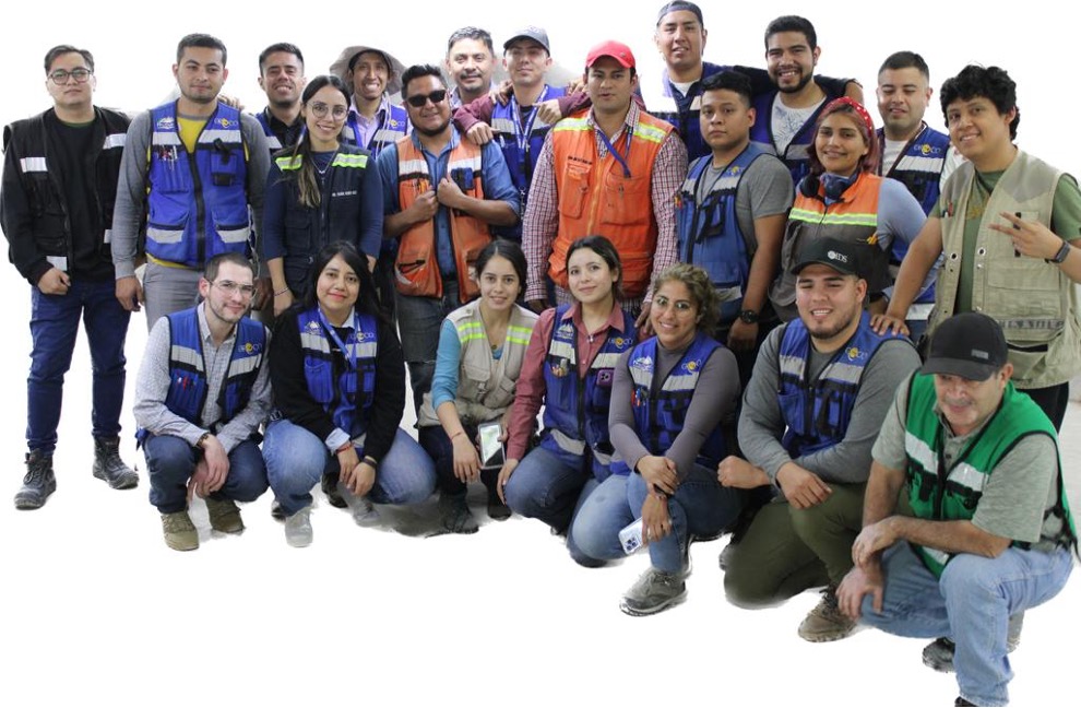
Above: The Site Team based at Ranchito: as our drill program reduces, we have commenced reduction of the Team through the month ahead. As final rotations for some commence, they’ve asked that we pass along their gratitude for their involvement, and best wishes for project success. We in turn will miss their involvement and camaraderie, and wish everyone the best of fortune in their endeavours.
The South Zone drill program will continue through mid-December. This maintains on-schedule drilling progress against the plans for PEA requirements prior to the Christmas break shutdown.
Some 617 samples (including duplicates and standards) were shipped from Ranchito to the assay lab during the week.
Geological modeling of the North Zone is now migrating to the ratification stage with the involvement and increasing oversight of external and independent consultants. Some re-logging of historical and early drill holes is being directed so as to ensure a fit-for-purpose model of North Zone is prepared on schedule.
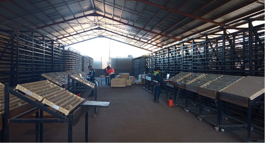
Selective relogging of core in the core storage facility: this work is continuing in parallel with aggressive logging and sampling of the new core being received from active drilling.
Metallurgical work continues and is building off initial comminution drop-weight tests and preliminary rougher kinetic tests to establish indicative flotation responses have been completed.
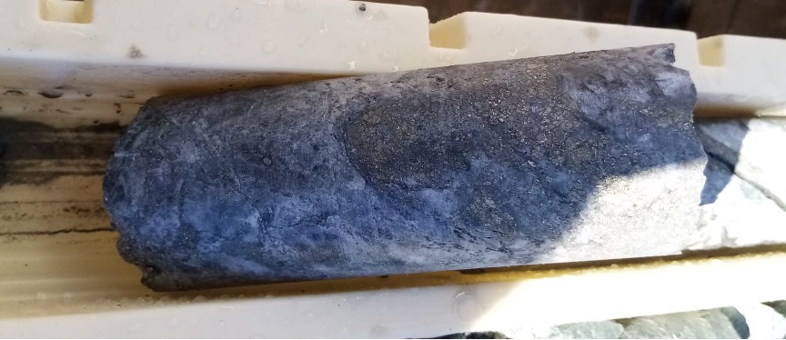
Hole S014 @ 232m
_____________________________________________
NEWS RELEASE – November 28, 2022
Oroco Expands North Zone Drilling
VANCOUVER, British Columbia – (November 28, 2022) Oroco Resource Corp. (TSX-V: OCO, OTC: ORRCF) (“Oroco” or “the Company”) announces assay results from drill holes N032 through N038 (4,046 m of drilling) of its drilling program in the North Zone of its Santo Tomas property (the “Property”) located in northwestern Mexico (see Table 1 below and Figure 1 attached, or at the Company’s website).
The Company is continuing to confirm and expand the 2009 Gradeshell model of Cu >0.30% (the “Gradeshell”) derived from the historical drilling described in the Company’s 2019 Technical Report. A total of 43 holes (28,119 m of drilling) have now been completed by the Company in the North Zone, spanning approximately 1,700 meters of strike length, with intersections of good-grade mineralization returned in all holes for which the Company has received assays
HIGHLIGHTS
- Drill holes N032 intersected good grade mineralization 300 m to the south of drill hole 20, the previous most southerly drill hole in the North Zone for which the Company has results, extending the strike of the North Zone to approximately 1,700 m. This sparsely drilled area of the deposit is prospective of greater width and depth than outlined in the historical modelling.
- Drill holes N033 and N034 were drilled down dip from hole N010 for the purpose of further delineating the central area of the North Zone. Both drill holes returned significant intervals of higher-grade mineralization.
- Drill holes N035 and N036 continued the Company’s efforts to confirm and expand the shallow-seated higher-grade mineralization along the central axis of the North Zone, with both holes returning significant intervals of higher-grade mineralization.
- N037 and N038, were each collared on the west side of the central spine of the deposit and continued to expand the mineralized zone to the west of the Gradeshell with intervals of good-grade mineralization.
- N037, downdip of N021, N024, N002 and N006 and approximately 200 m west of the Gradeshell, shows that mineralization in this area is largely contained within the hanging wall. Notably, mineralization appears to be improving to depth.
- N038 intersected a zone of mineralization similar in nature to that of N037, with the best grade intervals being found in the hanging wall to the west of the Gradeshell. Notably, N038 demonstrates that this area of the North Zone broadens to a very significant width lying within 75 m of the surface on the western flank of the Santo Tomas ridge.
Richard Lock, CEO, commented: “We are very pleased with these drill results as we continue to extend the area of the shallow-seated higher-grade mineralization further south, extending the strike of the North Zone significantly, and expanding the width of the deposit to the west.”
DRILLING RESULTS
All drill holes tested the North Zone deposit perpendicular to its structural attitude. Core intervals are within approximately 10% of true thickness.
Drill hole N032 (Plate 40) returned two intervals of significant mineralization, with the most significant being 88 m of 0.37% copper equivalent (“CuEq”).
Drill hole N033 (Plate 53) returned a number of closely spaced intervals starting above, and extending through and below the Gradeshell, with the two most significant being 31.7 m of 0.34% CuEq and 90.1 m of 0.32% CuEq.
Drill hole N034 (Plate 53) returned two main mineralized intervals with the most significant being 267 m of 0.40% CuEq.
Drill hole N035 (Plate 48) returned four main mineralized intervals, the most significant of which is 220.5 m of 0.42% CuEq.
Drill hole N036 (Plate 48), the best hole of this series, returned a mineralized interval of 139.6 m of 0.51% CuEq.
Drill hole N037 (Plate 61) returned one significant interval of 192.6 m of 0.26% CuEq.
Drill hole N038 (Plate 49) returned five mineralized intervals with the two most significant being 32.5 m, starting approximately 75 m from the surface, of 0.34% CuEq and 94.5 m of 0.36% CuEq.
To view an interactive 3D model that includes the results announced today, use the following link: https://vrify.com/companies/oroco-resource-corpor visit the Company’s website.
Table 1: Significant Assay Intervals in the Santo Tomas 2021-2022 Program, Holes N032 to N038:
Drill Hole
No. |
Dip |
From
(m) |
To
(m) |
Length
(m) |
Cu
% |
Mo
% |
Au
g/t |
Ag
g/t* |
CuEq
% |
| N032 |
-55 |
247.0 |
260.0 |
13.0 |
0.13 |
0.002 |
0.025 |
0.72 |
0.16 |
| " |
-55 |
280.3 |
369.0 |
88.7 |
0.34 |
0.005 |
0.021 |
2.27 |
0.37 |
| N033 |
-80 |
141.0 |
164.8 |
23.8 |
0.18 |
0.002 |
0.010 |
0.96 |
0.20 |
| " |
-80 |
169.0 |
239.7 |
70.7 |
0.21 |
0.007 |
0.022 |
1.45 |
0.25 |
| " |
-80 |
242.3 |
274.0 |
31.7 |
0.29 |
0.008 |
0.028 |
2.52 |
0.34 |
| " |
-80 |
286.9 |
377.0 |
90.1 |
0.25 |
0.014 |
0.009 |
1.80 |
0.32 |
| " |
-80 |
397.9 |
418.4 |
20.5 |
0.16 |
0.001 |
0.007 |
1.54 |
0.17 |
| " |
-80 |
437.5 |
454.0 |
16.5 |
0.16 |
0.001 |
0.009 |
1.48 |
0.17 |
| N034 |
-55 |
163.0 |
430.0 |
267.0 |
0.34 |
0.011 |
0.029 |
2.57 |
0.40 |
| " |
-55 |
444.0 |
454.0 |
10.0 |
0.12 |
0.001 |
0.004 |
1.20 |
0.12 |
| N035 |
-80 |
89.5 |
310.0 |
220.5 |
0.37 |
0.006 |
0.042 |
2.15 |
0.42 |
| " |
-80 |
318.0 |
328.0 |
10.0 |
0.13 |
0.000 |
0.005 |
1.04 |
0.13 |
| " |
-80 |
336.0 |
346.0 |
10.0 |
0.16 |
0.000 |
0.010 |
1.34 |
0.17 |
| " |
-80 |
368.0 |
380.0 |
12.0 |
0.15 |
0.001 |
0.007 |
1.39 |
0.16 |
| N036 |
-50 |
110.4 |
250.0 |
139.6 |
0.43 |
0.002 |
0.092 |
2.47 |
0.51 |
| N037 |
-75 |
322.2 |
514.7 |
192.6 |
0.21 |
0.011 |
0.013 |
1.91 |
0.26 |
| " |
-75 |
620.0 |
632.0 |
12.0 |
0.10 |
0.002 |
0.004 |
1.03 |
0.11 |
| N038 |
-50 |
75.0 |
107.5 |
32.5 |
0.28 |
0.011 |
0.020 |
1.78 |
0.34 |
| " |
-50 |
114.0 |
208.5 |
94.5 |
0.29 |
0.014 |
0.023 |
2.53 |
0.36 |
| " |
-50 |
213.5 |
284.0 |
70.5 |
0.17 |
0.009 |
0.007 |
1.32 |
0.21 |
| " |
-50 |
310.0 |
370.0 |
60.0 |
0.22 |
0.016 |
0.008 |
2.01 |
0.29 |
| " |
-50 |
386.0 |
400.8 |
14.8 |
0.14 |
0.003 |
0.006 |
2.03 |
0.16 |
Cu Equivalent (CuEq) % = Cu % + (Mo %*3.75) + (Au ppm*0.752). The commodity prices (3-year Average) used are in $US: Cu $3.20 /lb, Mo $12.00 /lb, and Au $1,650.00 /troy oz. * Ag values are not used in the CuEq calculations.
NORTH ZONE PROGRAM
The Company has now completed 43 drill holes (28,119 m of drilling) in its 2021-2022 North Zone drilling confirming good grade mineralization along 1,700 m of strike, demonstrating a westward dipping panel with consistent grades down-dip to about 400-500 m depth below the ridge, bottoming about sea level. Importantly, the drill program has confirmed and expanded a zone of shallow-seated higher-grade mineralization extending down the central spine of the North Zone that is amenable to early year, low strip, open pit mining and delineated a mineralized hanging wall zone to the west of the Gradeshell that comes close to surface under the Santo Tomas ridge.
The program is nearing completion with the remainder of the program focussed on expanding the shallow seated mineralized zone on the hanging wall along the south-west side of the Gradeshell with the continued goal of increasing the resource in this newly identified zone.
SOUTH ZONE PROGRAM
The Company’s 2022 South Zone drill program includes 18 holes that are expected to be completed by the end of November, with 13 holes (7,964 m of drilling) completed to date.
TECHNICAL INFORMATION AND QUALITY CONTROL / QUALITY ASSURANCE
The historical drilling data employed in this current exploration program was the subject of Data Verification procedures cited in the current Technical Report. Additional drill collar verifications were performed in the current program, and collar locations fit closely to the 2021/2022 survey control. Appropriate QA/QC protocols governed geological logging, core sampling, sample preparation, analyses, and security during the current program, including quality controls with duplicates, standards, and blanks. Samples were submitted to the Mexican division of ALS Limited in Hermosillo, Mexico, for sample preparation to pulps. Sample pulps are then sent to ALS Canada Ltd. in Vancouver, Canada, for analysis. Total copper and molybdenum contents are determined by four-acid digestion with AAS finish. Gold was determined by fire assay of a 50-gram charge, or alternately, of a 30-gram charge (1 Assay ton).
QUALIFIED PERSON
Mr. Paul McGuigan, P. Geo., of Cambria Geosciences Inc., a “Qualified Person” (as defined in NI 43-101 -Standards for Disclosure for Mineral Projects) and a senior consulting geoscientist to the Company, has reviewed and approved the technical disclosures in this news release. The Company strictly adheres to CIM Best Practices Guidelines in conducting, documenting, and reporting the exploration activities on its projects.
ABOUT OROCO:
The Company holds a net 85.5% interest in the collective 1,172.9 ha Core Concessions of the Santo Tomas Project in NW Mexico. The Company also holds an 80% interest in 8,154.3 ha of mineral concessions surrounding and adjacent to the Core Concessions (for a total project area of 23,048 acres). The Project is situated within the Santo Tomas District, which extends from Santo Tomas up to the Jinchuan Group’s Bahuerachi project, approximately 14 km to the northeast. Santo Tomas hosts a significant copper porphyry deposit defined by prior exploration spanning the period from 1968 to 1994. During that time, the property was tested by over 100 diamond and reverse circulation drill holes, totalling approximately 30,000 meters. Based on data generated by these drill programs, a historical Prefeasibility Study was completed by Bateman Engineering Inc. in 1994.
The Santo Tomas Project is located within 160km of the Pacific deep-water port at Topolobampo and is serviced via highway and proximal rail (and parallel corridors of trunk grid power lines and natural gas) through the city of Los Mochis to the northern city of Choix. The property is reached by a 32 km access road originally built to service Goldcorp’s El Sauzal Mine in Chihuahua State.
Neither TSX Venture Exchange nor its Regulation Services Provider (as that term is defined in the policies of the TSX Venture Exchange) accept responsibility for the adequacy or accuracy of this release.
Cautionary Note Regarding Forward Looking Information
This news release includes certain “forward-looking information” and “forward-looking statements” (collectively “forward-looking statements”) within the meaning of applicable Canadian securities legislation. All statements, other than statements of historical fact included herein, including, without limitation, statements relating to future events or achievements of the Company, are forward-looking statements. There can be no assurance that such forward-looking statements will prove to be accurate, and actual results and future events could differ materially from those anticipated or implied in such statements. Many factors, both known and unknown, could cause actual results, performance or achievements to be materially different from the results, performance or achievements that are or may be expressed or implied by such forward-looking statements. Readers should not place undue reliance on the forward-looking statements and information contained in this news release concerning these matters. Oroco does not assume any obligation to update the forward-looking statements should they change, except as required by law.
_____________________________________________
@Orococorp